Rain Capture Interactive Maps for Dam Placement
The index page for the list of currently available maps is http://AirSolarWater.com/dem
Dryland rain capture proven by the Ancient Aztec
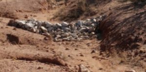 The Aztecs were able to survive and thrive in a very dry area by harvesting the seasonal rains. They built low walls to capture runoff and silt. Over time the reservoirs captured water and soil that supported increased crop production.
They were able to convert rugged dry terrain into relatively large fertile and well watered fields supporting intensive agriculture letting mother nature due most of the work. The water and soil eventually filled the reservoir giving them a new level growing parcel. As the reservoir filled with soil they kept adding to the wall to hold a few inches of water on the growing area. This gave them deep pockets of well watered soil where they could grow crops that would never have survived using traditional rain-fed agriculture.
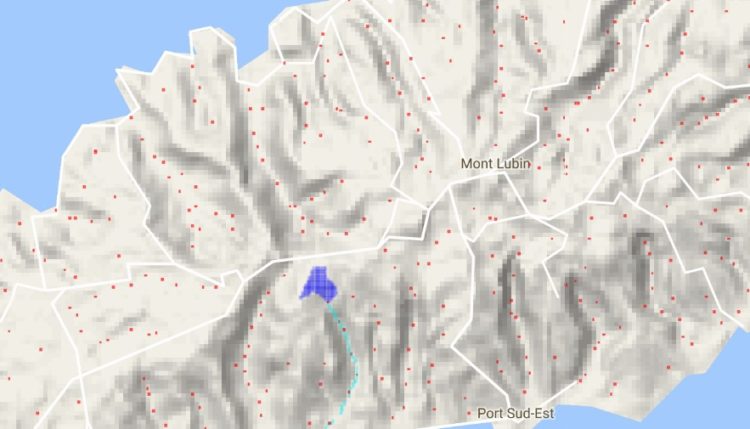
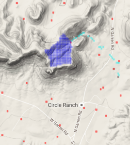 Modern Software & NASA data to place Dams
The Aztecs were limited in check dam placement to areas where water flow was relatively obvious. Our algorithms analyze digital elevation maps to determine where water is likely to flow and then uses this data to recommend locations for thousands of reservoirs each capturing water and valuable soil.
Our software enabled by NASA DEM (Digital Elevation maps) to help identify thousands of locations where check dams, spreader walls or retaining walls can be built to capture water and build enriched growing pockets.
The index page for the list of currently available maps is http://AirSolarWater.com/dem
[paypal-donation purpose=”Ease Water Scarcity” reference=”rain capture”]
Many areas suffering from water scarcity go through a cycle of plenty of water during the rainy season only to have starving animals latter in the year. Our process with the check dams helps slow the flow of water so it has time to soak in and recharge the aquifer. It spreads the water over growing parcels capturing the silt and creating a deeply saturated column of enriched soil. Deep rooted plants can grow here throughout the year producing animal feed even when surrounding grasses and plants have withered due to drought.
This process is one of the least expensive and fastest acting ways to reverse desertification and reverse the effects of deforestation.
Please contact us in with your suggestions. ![]()
![]()
Thanks, Joe Ellsworth
Table Of Content
admin • 2016-11-30