Air Solar Water & Rain Capture

Ease Water Scarcity around the work using Rain Capture

Rain Capture Interactive Maps for Dam Placement

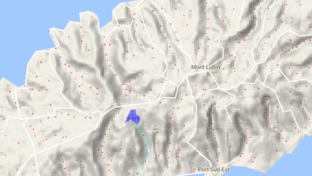
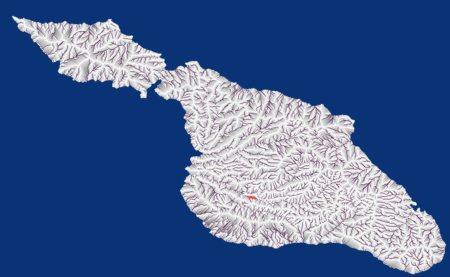
The index page for the list of currently available maps is  http://AirSolarWater.com/dem Dryland rain capture proven by the Ancient Aztec The Aztecs were able to survive and thrive in a very dry area by harvesting the seasonal rains.   They built low walls to capture runoff and silt.   Over time the reservoirs captured water…

Continue Reading

Modeling Water flow using DEM (Digital Elevation Models)

Water flow Analysis showing where micro Check dams can be located Grey areas show where water can be captured using micro-check dams so every major storm will refill the  reservoir. Dark lines represent large water flow areas were larger professionally engineered  dams are needed and are likely riparian zones. White areas are those where this…

Continue Reading

1

Improve Economic Prospects for Poor Rural Farmers

Small village farmers on Mauritius and Rodrigues Islands have been forced by water scarcity  to reduce the amount of land they can cultivate by 2/3  In some instances they have been forced to purchase expensive water from retailers bringing it around on carts. This has reduced their farm income and pushes them closer to poverty….

Continue Reading

Micro-Capture to increase food production in dryland areas

This article discusses a low cost way to increase the food production on desert and degraded lands while reducing the impact of droughts.  This is accomplished without increasing demand for ground water and can even help recharge the local aquifer.  This is accomplished by maximizing water retention on the land where rain water falls so…

Continue Reading